From Thung Tuk to the Takua Pa River: The Day the Waterway Built the Town
The river is not just a backdrop. It is a route, a connector of people, and the determiner of the town's fate, which had to relocate due to sedimentation.
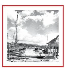
If you stand by the Takua Pa River today, the slow and quiet water might seem like a mere backdrop to the old town landscape. However, looking back into history, this river never slept. It was the main artery that pumped prosperity, people, and resources into the area for centuries.
Takua Pa town was not located at its current coordinates from the beginning. It shifted and grew along the waterway, moving from the flatland near the estuary to the Talat Yai area, until the day river sediment forced the town centre to relocate once again.
The Takua Pa River is therefore not just a natural landscape, but the true author of history that brought global maritime commerce to the area, and the determiner of the town's destiny when the waterway became shallow.
Thung Tuk, the Port Before the Town
Before the image of Takua Pa town became the brick buildings and Sino-Portuguese commercial districts we see today, the original trade centre of this area was located at Thung Tuk, a flatland near the river mouth. Thung Tuk served as a bustling ancient trading port on the trans-peninsular route.
This estuary area did not grow in isolation. It was a crucial piece connecting to an extensive maritime trade network. It served as a stopover and goods exchange point for travellers of various nationalities, who relied on ocean currents and seasonal monsoons for navigation.
The Takua Pa waterway during that era was not solely for local transportation. It was used as a primary trans-peninsular route between the Andaman Sea and the Gulf of Thailand. With a favourable distance between the headwaters on both sides, this route drastically reduced travel time.
Importantly, using the river route helped navigators avoid the dangers and risks of sailing around the long Strait of Malacca. The waterway therefore acted as a bridge connecting two oceans, continuously bringing people, goods, and cultures into the area. This was the first chapter of the port town, before the centre of prosperity expanded deeper inland along the river.
Takua Pa town was not located at its current coordinates from the beginning. It shifted and grew along the waterway.
The Steam Boiler and the Prosperity of Talat Yai
As eras transitioned and maritime trade moved further inland, the town centre relocated to the Talat Yai community during the town's restoration in the reign of King Rama III. This area was surrounded by the river on three sides, making it highly suitable for both town defence and water transportation.
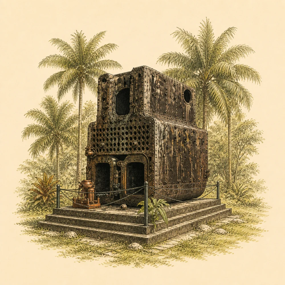
Takua Pa's water trade continued to flourish and left material traces visible to this day. If you travel to Wat Pathum Thara, or Wat Na Mueang (the town's front temple), in the Talat Yai area, you will find a large steam boiler on display. This metal piece is not mining machinery, but a crucial component of a historical steamboat.
Phraya Sena Nuchit (Nuch Na Nakhon) partnered with Phraya Wichit Songkhram to purchase this steamboat in 1867 (2410 B.E.) to transport goods and suppress pirates in the waters. It serves as proof of the wealth and heavy traffic volume during that era.
Although the steamboat later deteriorated and sank in the Takua Pa River, the salvaged steam boiler still stands as a witness. The vibrancy of the Talat Yai community at that time was inextricably linked to the river. The people's way of life relied on the waterway, which functioned as the town's main street.
The Day Sediment Accumulated and the Town Had to Move

But the river is never static, and nature always plays a role in shaping the town's fate. Over time, sediment from the rapidly growing tin mining industry and natural phenomena accumulated until the Takua Pa River became increasingly shallow.
This geographical change directly impacted the town's economic structure. Navigation, once convenient, decreased and became more difficult. Large merchant ships that previously brought wealth could no longer dock as easily as before, causing the vibrancy of the Talat Yai community to decline.
Eventually, the town centre had to relocate from the original Talat Yai area to a new district called Yan Yao in 1913. This relocation was not caused by war or epidemics, but by the limitations of the changed waterway, which was no longer conducive to trade.
This historical event proves that the river had complete influence over human settlement. The day the water became shallow was the day the town had to pack its bags and move to breathe new life into an area better able to accommodate the changes.
Boonsoong Iron Bridge, the Miners' Connection
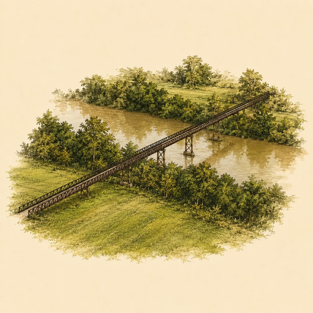
As the town centre transitioned from the commercial port era to the golden age of tin mining, the riverside landscape and infrastructure were modified accordingly. In the past, the Takua Pa Canal was over forty metres wide, presenting a natural barrier that divided the area.
The width of the waterway meant miners and locals had to row boats back and forth between the old market side and the mining company's area. To solve this difficult commute, especially during the flood season when the current was swift, Mr Juti Boonsoong, founder of the tin dredging company, initiated the construction of a wooden bridge first, allowing people to walk and ride bicycles across.
Later in 1968, the bridge underwent a major renovation. Steel from decommissioned tin dredges was assembled to rebuild the Khok Khanun Iron Bridge, or as we familiarly know it, the Boonsoong Iron Bridge, spanning over two hundred metres across the river.
This iron bridge is therefore not just a construction object or an engineering structure. It is a shortcut that reduced travel time for workers, a goods transport route, and a connection for daily life. This landmark tells the story of the transition from the rowboat era to the mining industry era that powerfully sustained the town's economy.
Water Catchment and Merit-Making at Thung Phra Pho
The Takua Pa River not only sustains the economy but is also tied to daily life and how locals cope with nature. Riverside areas like Thung Phra Pho Public Park are clear examples of adapting to coexist with the old town's water system.
Municipal planning documents indicate that the Thung Phra Pho area is important as water management infrastructure, with projects to dredge the canal and construct a pier. During times when the town faces flooding, this area is also used as an installation point for water pumps to alleviate floods for the community.
However, beyond the dimension of dealing with natural disasters, Thung Phra Pho is also an open space for cultural activities. On the full moon day of the twelfth lunar month every year, this wide riverside plaza is used as the venue for the municipality's annual Loy Krathong (November lantern-floating festival).
This diverse usage reflects that the riverside areas were not abandoned after the mining era. Instead, their functions were adapted to become both a town defence mechanism and an activity plaza that brings people together on merit-making days.
Traces Still Flowing in the Present Landscape
Today, although the mines have closed and large-scale maritime trade has become merely a past recorded on paper pages, many riverside locations are still alive and harmoniously coexist with the breath of the people in Takua Pa old town.
The Boonsoong Iron Bridge continues to serve as a community thoroughfare, where locals still walk and ride motorcycles back and forth. At the same time, it has become a landmark where people come to enjoy the view and take photos of the old dredge factory traces still visible from the bridge, or even being used as a filming location for foreign movies.
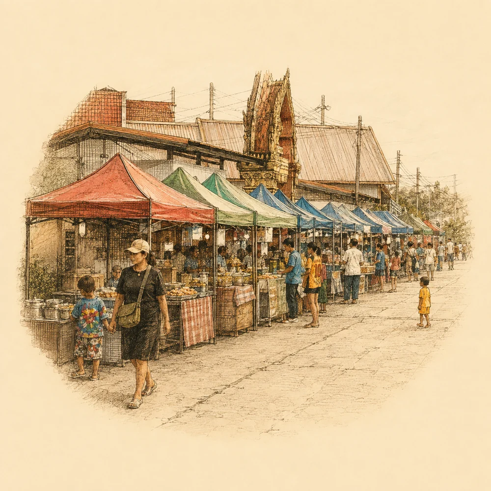
Along the canal near Wat Yan Yao (a local temple), a community market area named Takua Pa Riverside Market has been initiated to help revive the old atmosphere, allowing people to experience the riverside way of life once again. There are also seafood festivals held according to the cultural calendar.
The Takua Pa River continues to flow slowly. It is a guardian of memories from the days when it was a global port town crowded with merchant ships, to the day it became the tranquil viewpoint of the old town we see today.
Where to visit in person
Takuapa Riverwalk
Boon Soong Iron Bridge
Wat Pathum Thara (the front town temple)
Thung Phra Pho Park
Missing data
- Architectural characteristics and town layout details of the Thung Tuk port in the era prior to the tin mining trade
- Contemporary photographs with clear usage rights depicting the congestion of water traffic during the era when steamboats were still operating
- Documents officially recording the day of the relocation to Yan Yao, and the voices of the villagers in the Talat Yai community at that time
Sources
- ทุ่งตึกเมืองท่าการค้าโบราณ · กรมศิลปากร · บทความแหล่งโบราณคดีทุ่งตึก · View sources (Accessed 2026-09-07)
- Takua Pa Old Town Documents · สำนักงานนโยบายและแผนทรัพยากรธรรมชาติและสิ่งแวดล้อม (สผ.) · PDF หน้า 11–13, 55–56, 58 · View sources (Accessed 2026-09-07)
- ฐานข้อมูลแหล่งโบราณคดี: ชุมชนตลาดใหญ่ · ศูนย์มานุษยวิทยาสิรินธร · ข้อมูลประวัติศาสตร์ชุมชน · View sources (Accessed 2026-09-07)
- สะพานเหล็กบุญสูง (โคกขนุน) · ฐานข้อมูลท้องถิ่นภาคใต้ มหาวิทยาลัยสงขลานครินทร์ · หน้าประวัติและภาพรวม · View sources (Accessed 2026-09-07)
- เอกสารแผนการดำเนินงานด้านสิ่งแวดล้อม พ.ศ.2565 · เทศบาลเมืองตะกั่วป่า · ระเบียนโครงการและการจัดการน้ำ · View sources (Accessed 2026-09-07)
- ข่าวน้ำท่วมตะกั่วป่าและการติดตั้งเครื่องสูบน้ำ · MGR Online · ข่าวภูมิภาค · View sources (Accessed 2026-09-07)
- ตลาดริมน้ำตะกั่วป่า ร่วมใจประชารัฐ · กรมการค้าภายใน กระทรวงพาณิชย์ · ข้อมูลตลาดต้องชม · View sources (Accessed 2026-09-07)
- ข่าวเช้า: สะพานเหล็กบุญสูง · NBT2HD · รายการข่าว 30 มกราคม 2569 · View sources (Accessed 2026-09-07)
- ปฏิทินเทศกาลอาหารทะเล ตลาดริมน้ำตะกั่วป่า · กระทรวงวัฒนธรรม · ปฏิทินกิจกรรมวัฒนธรรม · View sources (Accessed 2026-09-07)