Then · Before · Now
ThenFrom a tin dredger to a workers' bridge
พ.ศ. 2503-2511 / ค.ศ. 1960-1968
Verifiedเรื่องของสะพานเริ่มขึ้นในเมืองตะกั่วป่ายุคเหมืองดีบุก เมื่อบริษัทเรือขุดแร่บุญสูงตั้งอยู่คนละฟากกับตลาดเก่า คลองตะกั่วป่ากว้างกว่า 40 เมตรทำให้คนงานและชาวบ้านต้องพายเรือข้ามไปมา และลำบากเป็นพิเศษเมื่อน้ำหลาก ฐานข้อมูลท้องถิ่นของมหาวิทยาลัยสงขลานครินทร์ระบุว่านายจุติ บุญสูง ผู้ประกอบการเหมือง จึงริเริ่มทำสะพานไม้ให้เดินและขี่จักรยานได้ก่อน
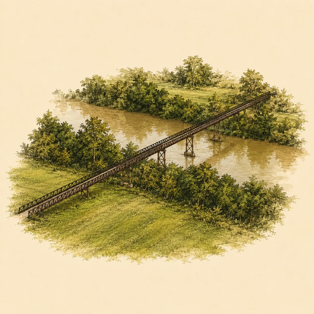
ต่อมาใน พ.ศ. 2511 มีการนำเหล็กจากเรือขุดแร่ที่เลิกใช้งานมาประกอบเป็นสะพานเหล็กโคกขนุน ยาวกว่า 200 เมตร ข้ามแม่น้ำตะกั่วป่า สะพานจึงไม่ใช่เพียงโครงสร้างอุตสาหกรรม แต่เป็นทางลัดของแรงงาน ทางขนสินค้า และทางเชื่อมชีวิตประจำวันระหว่างตลาดเก่ากับพื้นที่เหมืองของเมืองที่ขับเคลื่อนด้วยแร่ดีบุก หลักฐานที่ตรวจสอบได้ยืนยันบทบาทเหมืองและการสัญจร แต่ยังไม่พบเอกสารร่วมสมัยที่อธิบายรายละเอียดเรื่องการค้าทางทะเล คนจีนฮกเกี้ยน หรือระบบเจ้าเมืองให้โยงตรงกับสะพานแห่งนี้
BeforeWhen the mines went quiet, the bridge became a mining town trace
หลัง พ.ศ. 2511-ก่อน พ.ศ. 2569 / ค.ศ. 1968-2026
Verifiedเมื่อกิจการเหมืองแร่ยุติลง สะพานไม่ได้หายไปพร้อมโรงขุดแร่ แต่เปลี่ยนบทบาทจากโครงสร้างเพื่อการทำงานเป็นทางสัญจรของชุมชนและหลักฐานภูมิทัศน์อุตสาหกรรม แหล่งข้อมูลของ ONEP ระบุว่ายังมองเห็นโรงขุดแร่เก่าที่คงสภาพเดิมได้จากบริเวณสะพาน ขณะที่แหล่งท่องเที่ยวร่วมสมัยเรียกสะพานนี้ว่าเป็นสัญลักษณ์ของอดีตเมืองแร่ตะกั่วป่า
ในช่วงต่อมา สะพานถูกเล่าและนำเสนอเป็นจุดท่องเที่ยวและจุดถ่ายภาพ รวมถึงปรากฏเป็นโลเคชันในภาพยนตร์ Wonderful Town (2007) ตามบทความติดตามสถานที่ถ่ายทำ อย่างไรก็ตาม การตรวจสอบครั้งนี้ยังไม่พบหลักฐานยืนยันปีที่เหมืองปิด ปีที่มีการซ่อมบูรณะครั้งใหญ่ ผลกระทบโดยตรงจากสึนามิ พ.ศ. 2547 หรือการขึ้นทะเบียนเป็นโบราณสถานของกรมศิลปากร จึงไม่ควรเติมเหตุการณ์เหล่านี้เป็นข้อเท็จจริง
NowA mining heritage that remains a passageway and destination
2569 / 2026
Verifiedปัจจุบันสะพานเหล็กบุญสูงยังทำหน้าที่เป็นทางสัญจรของชุมชน โดยมีข้อมูลภาคสนามและรีวิวระบุว่าชาวบ้านใช้เดินทางและรถจักรยานยนต์ผ่าน ขณะเดียวกันเทศบาลเมืองตะกั่วป่าจัดไว้ในหมวดแหล่งท่องเที่ยว และแหล่งท่องเที่ยวของ ททท. มีภาพปัจจุบันของสถานที่นี้ สะพานจึงอยู่กึ่งกลางระหว่างโครงสร้างใช้งานจริงกับแลนด์มาร์กที่คนมาเดินชมวิวและถ่ายภาพ
หลักฐานล่าสุดที่พบคือข่าว NBT วันที่ 30 มกราคม 2569 ซึ่งพาไปรู้จักสะพานในฐานะมรดกเหมืองแร่คู่เมืองตะกั่วป่า และระบุว่าช่วงนั้นมีการปิดชั่วคราวเพื่อรองรับการถ่ายทำภาพยนตร์ต่างชาติ นอกจากนี้เอกสารงบประมาณเทศบาลที่ค้นพบมีรายการเกี่ยวกับการบำรุงรักษาและปรับปรุงบริเวณทางเข้าสะพาน แต่ยังไม่พบเอกสารยืนยันโครงการบูรณะตัวโครงสร้างโดยตรง ตารางเวลาเปิด-ปิด ค่าเข้าชม ผู้ดูแลเฉพาะกิจกรรม และสภาพความปลอดภัยล่าสุดจึงยังต้องตรวจสอบหน้างาน
Dot timeline
- Verified
พ.ศ. 2503
Juti Boon Soong took over the mining business
Local databases indicate that Mr. Juti Boon Soong bought the Takua Pa Valley dredging company and discovered commuting difficulties for workers and locals between the old market and the company area.
Read source ↗ - Verified
พ.ศ. 2511
Construction of Khok Khanoon iron bridge
Iron from a decommissioned tin dredger was used to build a bridge over 200 metres long across the Takua Pa River, connecting the town with the mining area and factory.
Read source ↗ - Not verified
2007 (2550)
Featured as a location in the film Wonderful Town
Articles tracking filming locations state that the bridge was a setting in the Thai film Wonderful Town. This is not verified by official production documents, only by audience articles.
Read source ↗ - Verified
2020 (2563 BE)
Municipality included the bridge entrance area in budget documents
Discovered municipal budget documents contain an item for the maintenance and improvement of land and structures around the entrance of the Boon Soong iron bridge. This is not evidence of a restoration of the bridge itself.
Read source ↗ - Verified
30 มกราคม 2569
NBT reported the bridge as a mining heritage site
NBT reported that the bridge is a historical landmark and was temporarily closed that week to accommodate the filming of a foreign movie.
Read source ↗ - Verified
Year unspecified
The wooden bridge came first
A wooden bridge was built for workers to walk and cycle across the canal, as well as for locals to transport goods, but the reviewed sources do not specify the exact year.
Read source ↗
No image authorized for publication yet
Highlights to see
Steel structure about 200 metres long
Not verifiedThe bridge spans the Takua Pa river and connects the main road area with the old ore dredger site.
Read source ↗Traces of the mining industry
Not verifiedBuilt with steel from a decommissioned tin dredger, and the old dredger can be seen at the end of the bridge.
Read source ↗Fields and mountain views
Not verifiedFrom the bridge, green fields, trees, and mountain ranges are visible, making it suitable for sightseeing and photography.
Read source ↗Community transit route
Not verifiedThe bridge is still a route used by villagers, so one should be careful of vehicles while visiting.
Read source ↗News and updates
2026-01-30 · NBT2HD
Inviting check-ins at Boon Soong iron bridge, mining heritage of Takua Pa town
NBT presented the bridge as a mining heritage site and historical landmark, noting its temporary closure for a foreign film production.
Read source ↗Did you know
VerifiedThe iron bridge structure was built using steel from a decommissioned tin dredger, not new steel produced specifically for the bridge.
Read source ↗VerifiedBefore the iron bridge, workers and villagers had to use rowboats to cross the canal, and there used to be a wooden bridge for walking and cycling.
Read source ↗Not verifiedThe bridge appeared in a location tracking article for the film Wonderful Town (2007).
Read source ↗ Getting there
Takua Pa Town
Not verifiedTravel along Rat Bamrung Road towards Takua Pa old town; the bridge is on the left, about 2 kilometres from the town centre.
Read source ↗Nearby and similar places
FAQ
Opening hours
ข้อมูลยังไม่ยืนยัน · เข้าชมได้ตลอดทั้งวัน (ข้อมูลจากแหล่งท่องเที่ยวรอง)
มีที่จอดรถไหม
Reviews state that roadside parking is available with limited space, but this is not verified by official sources
Getting there from Takua Pa Town
Travel along Rat Bamrung Road towards Takua Pa old town; the bridge is on the left, about 2 kilometres from the town centre.
What is the history of this place?
พ.ศ. 2511 มีการนำเหล็กจากเรือขุดแร่มาสร้างสะพานเหล็กโคกขนุน ความยาวกว่า 200 เมตร ข้ามแม่น้ำตะกั่วป่า ผู้ริเริ่มคือ นายจุติ บุญสูง เจ้าของกิจการบริษัทเรือขุดแร่จุติบุญสูง จำกัด ซึ่งก่อตั้งบริษัทใน พ.ศ. 2503
What are the highlights to see?
สะพานทอดข้ามแม่น้ำตะกั่วป่าและเชื่อมพื้นที่ถนนหลักกับบริเวณโรงขุดแร่เก่า ใช้เหล็กจากเรือขุดแร่ที่ไม่ใช้งานแล้ว และปลายทางยังมองเห็นโรงขุดแร่เก่า จากสะพานเห็นทุ่งสีเขียว ต้นไม้ และทิวเขา เหมาะกับการชมวิวและถ่ายภาพ
Data Sources
| Name | Type | Date accessed | Link |
|---|
| สำนักงานนโยบายและแผนทรัพยากรธรรมชาติและสิ่งแวดล้อม: สะพานเหล็ก (โคกขนุน) | Official agency | 2026-09-07 | Open source ↗ |
|---|
| ฐานข้อมูลท้องถิ่นภาคใต้ มหาวิทยาลัยสงขลานครินทร์ (Southern Thai Local Database, Prince of Songkla University) | Other resources | 2026-09-07 | Open source ↗ |
|---|
| TrueID Travel: สะพานเหล็กบุญสูง | Blog | 2026-09-07 | Open source ↗ |
|---|
| TAT Media Assets: Boon Soong Iron Bridge | Official agency | 2026-09-07 | Open source ↗ |
|---|
| เทศบาลเมืองตะกั่วป่า (Takua Pa Town Municipality): Tourist attractions | Official agency | 2026-09-07 | Open source ↗ |
|---|
| Wongnai: พานเหล็กบุญสูง | Other resources | 2026-09-07 | Open source ↗ |
|---|
| สำนักงานนโยบายและแผนทรัพยากรธรรมชาติและสิ่งแวดล้อม (Office of Natural Resources and Environmental Policy and Planning) | Official agency | 2026-09-07 | Open source ↗ |
|---|
| เทศบัญญัติงบประมาณเทศบาลเมืองตะกั่วป่า (Takua Pa Town Municipality Budget Ordinance) | Official agency | 2026-09-07 | Open source ↗ |
|---|
| NBT2HD ข่าวเช้า | News | 2026-09-07 | Open source ↗ |
|---|
| TAT Media Assets: ภาพไฟล์ 1594919 | Official agency | 2026-09-07 | Open source ↗ |
|---|
| TAT Media Assets: ภาพไฟล์ 1098453 | Official agency | 2026-09-07 | Open source ↗ |
|---|
| Wonderful Town filming locations | Blog | 2026-09-07 | Open source ↗ |
|---|
Missing data
- Phone number, Facebook page, website, or official LINE of the location not found.
- Admission fee from checked sources not found.
- Official data regarding restrooms, parking, and wheelchair access not found.
- Verified distance or route data from Phuket, Khao Lak, or the airport not found.
- Festival data specific to the bridge not found.
- Evidence verifying the year and designer of the wooden or iron bridge, aside from the 1968 data and Mr Chuti Boon Soong, not found.
- Evidence of historical site registration by the Fine Arts Department not verified yet.
- Evidence that the bridge features Sino-Portuguese or Chinese architecture not found, so it cannot be concluded as such.
- Nearby places with a verified walking distance from read sources not found.
- Evidence verifying the year the mine closed or changes in ownership after the dredging company era not found.
- Evidence verifying the year and details of the bridge restoration not found.
- Evidence confirming direct impact from the 2004 tsunami not found.
- Registration as a historical site by the Fine Arts Department not found.
- Name of the agency or person directly responsible for the bridge structure in 2026 not found.
- Announcements for opening hours, admission fees, restrooms, parking, or latest safety standards not found.
- Historical photos with a public URL and clear sources not found.
- Photos from TAT have a file listing page, but usage rights are unknown and require permission before use.
- News from the past 5 years confirming restoration projects, traditional events, or awards specific to the bridge not found.